


COMPANY INSIGHT
Sponsored by: Carroll Technologies
Technology
Underground drones: how Hovermap is using autonomous technology to explore mines
Australian start-up Emesent has secured A$3.5m in funding to develop its Hovermap drones, which use autonomous technology to explore and map underground environments. JP Casey takes a closer look at the tech
Credit: Emesent founders Stefan Hrabar, the company’s CEO, and Farid Kendoul, its CTO.
The Commonwealth Scientific and Industrial Research Organisation (CSIRO), a department of the Australian Government responsible for scientific research and development, has invested in projects as varied as polymer banknotes and 3D-printed body parts, and claims to contribute around A$3.2bn a year to the Australian economy.
One of its latest projects is the Hovermap product, a system that uses autonomous drones to investigate underground areas to determine their suitability for mining operations. The technology was developed by start-up Emesent, founded by two former CSIRO members, and aims to improve the accuracy of underground mapping, where systems like GPS are ineffective, and reduce risks by removing human workers from potentially dangerous subterranean areas.
The CSIRO has raised A$3.5m through its Innovation Fund, with money coming from investors Main Sequence Ventures and ACAC Innovation, to further refine the system for use in underground mines, and expand its influence beyond the five countries where it has already been deployed.
Boddington gold mine
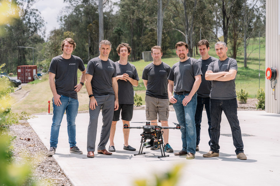
Emesent’s CEO and co-founder Stefan Hrabar has worked with the International Forum for Aviation Research, while CTO and co-founder Farid Kendoul has worked with NASA; between them, they have 28 years of experience in working with drones and start-up companies.
In 2017, the company completed a number of successful test flights, including a trial at South32’s Cannington mine in January, and the world’s first autonomous beyond line-of-sight drone flight in September, when a drone flew through Northern Star Resources’ Jundee gold mine in Western Australia, 600m below the surface. Emesent has also used the drones to participate in the US Defense Advanced Projects Agency’s Subterranean Challenge, which tests solutions for mapping and searching underground areas.
Newmont has also invested $500m in a significant expansion of the mine’s south pit in 2015
Credit: Emesent.
More than half of the country’s coal mines are managed by pro-Russian separatist militia.
Credit: DmyTo/Shutterstock.
Fimiston gold mine
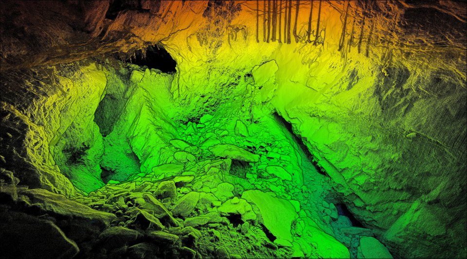
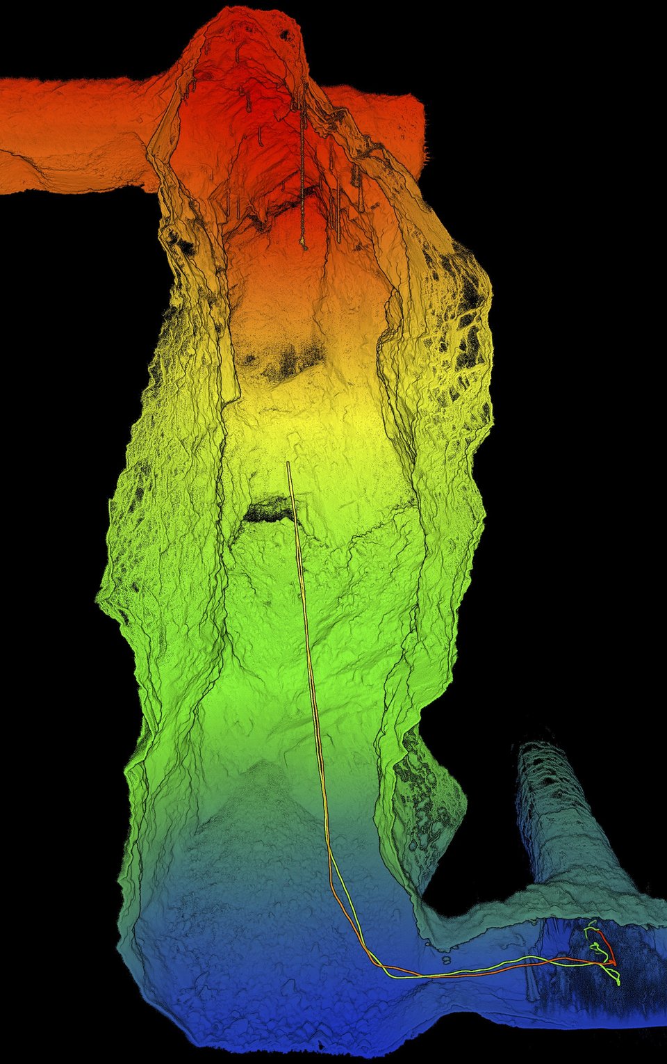
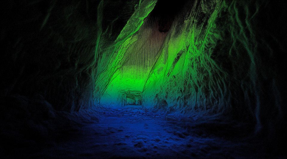
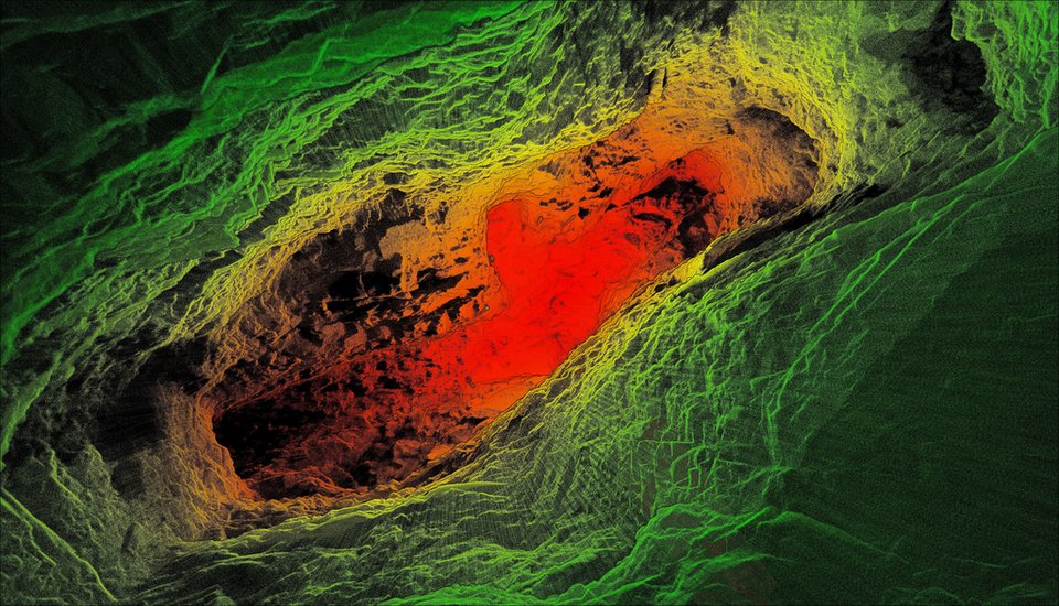
The drones fly autonomously and collect a range of information, such as the shape of a cave system, using a process known as simultaneous localisation and mapping (SLAM). SLAM enables drones to construct 3D images of their environments using a system called LiDAR, where the drone fires laser light at nearby structures, and measures how the light is reflected by the surfaces it hits. This process lets the drones produce accurate renditions of cave systems without the need for external services, such as GPS location, which is often ineffective underground.
The Hovermap drones are also able to record levels of gases and identify geological features, and can take photos and record videos of cave systems to aid in the construction of cave diagrams.
The mine has also suffered from a number of accidents in recent years, with its western and eastern walls partially collapsing
Credit: Emesent.
Fimiston gold mine. Credit: Newmont Mining.
Olympic Dam metal mine
One of the most impressive features of the technology is that the drones use the same data they collect to construct images of caves to locate themselves within the caves, a system that improves the quality of both sets of data. By using SLAM for both navigation and location, both elements are improved; the drones are reliant on collecting accurate data to remain in the air, which means they can stay in the air for longer, and ultimately collect more data to construct more accurate images of the cave systems.
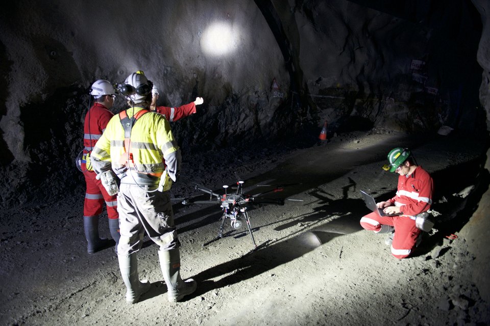
Emesent’s drones also offer significant safety benefits to workers. By removing the need for humans to enter unfamiliar underground areas to complete mapping work, workers are no longer expected to work in these potentially dangerous areas. The high quality of the drones’ recordings also safeguards future mining operations from the kind of mapping errors that contributed to the 2002 Quecreek mine disaster in the US, when nine miners were trapped after breaking into a passage they did not know was there, accidentally flooding the mine.
BHP has struggled to effectively extract the mine’s vast resources since buying previous owners WMC Resources
However, BHP has struggled to effectively extract the mine’s vast resources since buying previous owners WMC Resources in 2005 for AUD$9.2bn, as constant expansion projects have harmed the mine’s production totals in the short-term. Copper production slumped to 137,000 tonnes in 2018, a decline of 18% over 2017 figures, as maintenance work was completed on the mine’s smelter facilities in the first half of the year. Technical faults, such as an eight-week shutdown of the mine’s acid plant, have also caused production to struggle.
BHP has planned a series of further investments in the mine, including a proposed $2.1bn expansion in 2017 that the company claims would have increased the mine’s lifespan by 500 years. While the project was deemed too ambitious for work to begin immediately – the scheme aimed to increase production from around 150,000 tonnes per annum to 450,000 tonnes by the start of 2023 – BHP will reconsider the project in 2020.
Credit: Emesent.
Argyle diamond mine
The Hovermap drones are a significant upgrade to conventional cavity monitoring systems (CMS), which are typically used to map underground areas. CMS solutions involve placing a camera at the end of a pole, which is then inserted into passages. While this enables workers to record still images and videos from areas inaccessible to human workers, the technology is limited by physical constraints such as the length of pole and dimensions of the cave, and few CMS cameras are fitted with LiDAR technology. CMS images are also affected by shadows, as they build up images from photos and videos recorded at the site, while Hovermap’s SLAM system eliminates shadows from final images.
Credit: Emesent.
Argyle diamond mine
Emesent plans to use the CSIRO funding to take the drones to market, after a successful pilot scheme involving companies based in Australia, Canada, China, Japan and the US. The pilot scheme was backed by the Australian Science and Industry Endowment Fund, which funded the production of eleven drones, three for its own use, and eight for use by the early adopters.
Credit: Emesent.
Argyle diamond mine
The study was used to refine the technology behind the system, and in particular develop the drones’ autonomous capabilities from an early warning system alerting a human operator to the proximity of obstacles, to the fully-automated navigation system the drones now use. While Emesent intends to sell the drones as complete products to mining companies in the short term, it may push for further funding to license and sell the SLAM software itself to customers who want a more tailored system in the long term.
“The investment will give us the opportunity to build out our team from seven to 25, and make Emesent a global leader in drone autonomy and automated underground data collection and analysis," Hrabar said in a press release. "The data we gather improves a mine's productivity and provides a better understanding of conditions underground, all without sending surveyors and miners into potentially hazardous areas."
Credit: Emesent.

Eero Knuutila is Head of Service Development at Helsinki Airport.
Image courtesy: Helsinki Airport
Share this article!


