Company Insight
Sponsored by Genereso
Geospatial intelligence for efficient & transparent mining and metals supply chains
From metal prospecting to production, smarter decisions start here.
Main image credit:
Sourcing and managing critical geospatial data is a time-consuming challenge across the mining and metals supply chain. Genereso revolutionizes this process with geospatial exploration and production (E&P) data and ESG datasets, integrated with near real-time satellite imagery through customizable map apps. The result: faster, smarter decisions and streamlined operations. Teams can save up to 99% of the time spent collecting and processing data, unlocking efficiency across exploration, operations, and supply chains. No installation or setup required.
From exploration to downstream oversight: transforming the metal industry with near real-time geospatial and satellite solutions
Genereso is a Switzerland-based geospatial intelligence company delivering advanced data and tools for the global mining and metals industry. Our solutions combine authoritative geospatial datasets with complementary satellite imagery, all aggregated onto interactive map apps. These applications empower professionals to evaluate opportunities, monitor projects, optimize operations, manage risks, and meet sustainability objectives.
A seamless integration of E&P data, ESG, and imagery
Genereso integrates near real-time geospatial data from official and curated sources with high-resolution satellite imagery from multi-constellation Maxar, Planet, Sentinel, and Landsat. This fusion allows users to evaluate geological potential, monitor production activities, secure metal provision, assess environmental risks, and track ESG data. By combining data layers with interactive visualization, Genereso enables informed decision-making at every stage of the mining lifecycle.
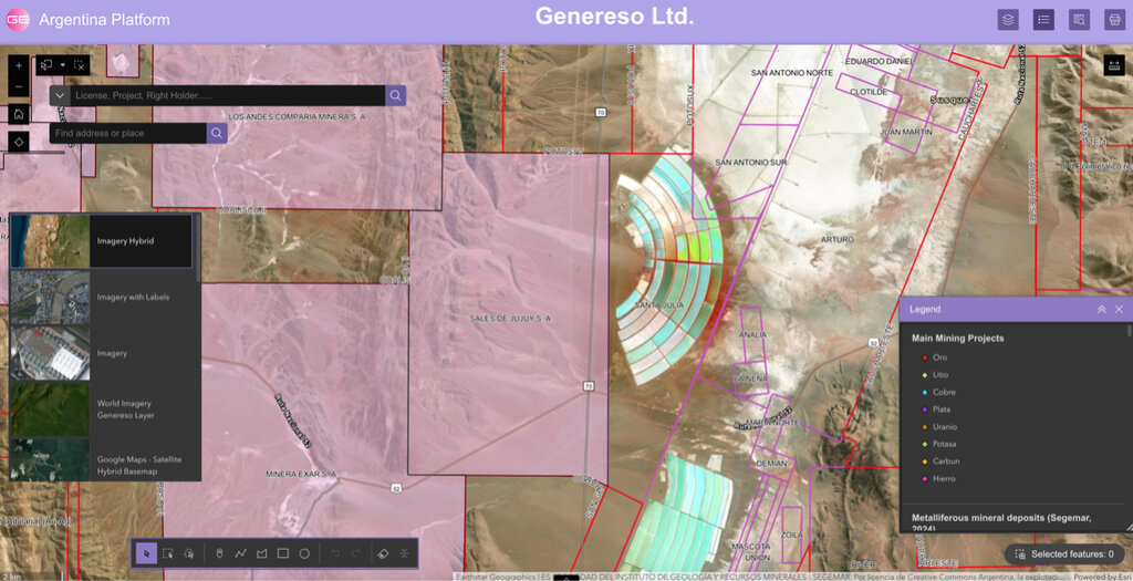
Salar de Olaroz (north) and Cauchari– Olaroz (south), Argentina: key lithium carbonate production sites for Arcadium Lithium (acquired by Rio Tinto) and Ganfeng Lithium, respectively.
Backed by Esri ArcGIS Online, Google Cloud, and AWS, Genereso’s cloud-based platform delivers reliable access to actionable insights from anywhere—no installation or setup required.
Comprehensive mining geodatabases at your fingertips
Genereso manages an ever-expanding portfolio of geospatial databases tailored to mining. These databases combine public and private datasets extracted with advanced machine learning and big data tools. With global coverage, they include:
- Mining projects and infrastructure – exploration sites, producing mines, plants, energy networks, and transport routes.
- Licenses and geology – detailed layers to support exploration and compliance.
- Environmental information – monitoring hazards, protected areas, and land-use change.
- Integrated ESG datasets – from live hazards such as wildfires or storms to long-term sustainability and governance data.
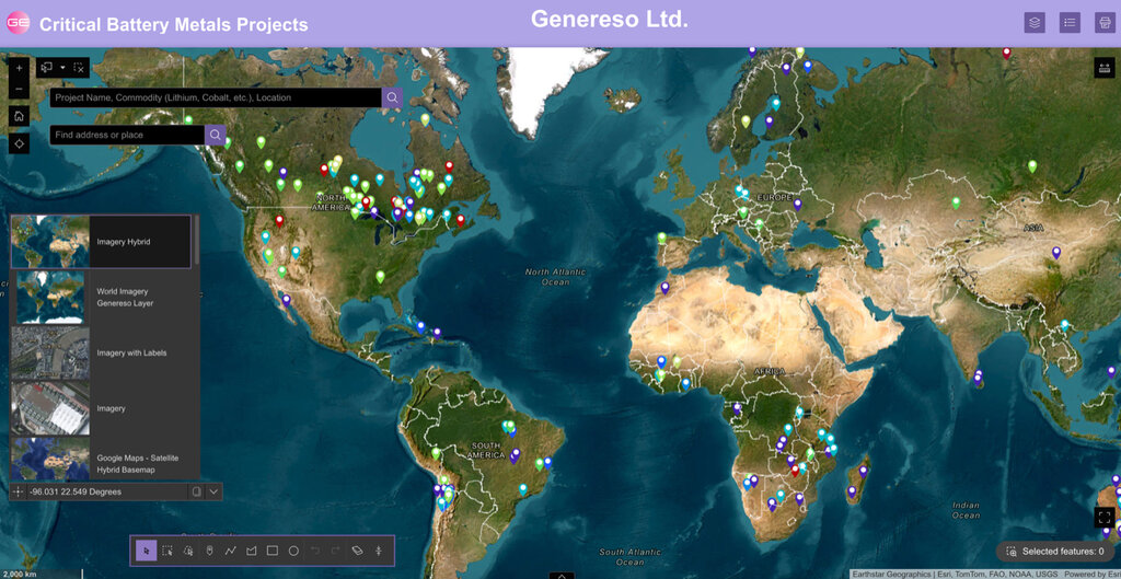
Database of reliable mining projects for key battery metals, with metadata on assets, ownership, reserves, and resources.
Together, these resources deliver the breadth and depth mining companies need to evaluate opportunities, anticipate risks, and optimize operations across diverse jurisdictions.
Monitoring supply chains with advanced tools
Genereso’s 2D and 3D monitoring applications deliver near real-time insights into mining and supply chain activities. By integrating ESG data with project and supplier information, users can assess exposure, monitor compliance, and generate detailed activity reports. This improves transparency and accountability, enabling mining and metals companies to strengthen supplier oversight and simplify global supply-chain management.
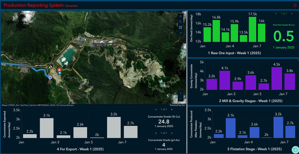
Dashboard example of a major copper and gold mine in Ecuador, showing ore processed and metal produced.
AI-driven mineral potential identification
Genereso also delivers AI-powered exploration tools designed to highlight promising mineral zones with minimal environmental impact. Machine learning algorithms analyze geological formations, spectral signatures, and historical datasets to identify high-potential areas. These capabilities accelerate exploration, reduce costs, and support field and office teams alike in focusing efforts where discovery is most likely.
Accessible and reliable geospatial solutions
Genereso’s cloud-based platform, built on Esri ArcGIS Online, Google Cloud and AWS, provides secure, role-based access to near real-time updates. Users can integrate their own proprietary data alongside global datasets, ensuring full compatibility and confidentiality. Field teams can collect and upload data that automatically synchronizes with their applications, while office teams can visualize and analyze results instantly. This seamless system simplifies complex workflows, reduces duplication, and ensures that decision-makers always work with the most current information.
Driving sustainability across the supply chain
Genereso supports sustainable practices by embedding ESG data into its platform. Clients can evaluate environmental and social risks, monitor governance standards, and reduce operational footprints. By visualizing ESG layers directly alongside mining projects and supply routes, organizations can ensure compliance, mitigate risks, and pursue responsible growth. This approach empowers mining and metals companies to meet evolving sustainability expectations while improving performance.
Why Genereso?
Genereso simplifies complex geospatial and ESG data, delivering the insights, tools, and AI-driven solutions needed to improve efficiency, reduce risks, and support sustainable practices. By integrating seamlessly into existing workflows, our platform gives mining professionals near real-time access to critical intelligence. With Genereso, companies can make faster, smarter decisions and remain competitive in a rapidly changing global industry.
Contact information
Genereso
Rue de Lausanne 67B
1202 Geneva,
Switzerland
Tel.: +41 22 740 20 20
Web: www.genereso.com