

Technology
BHP is trialling drones fitted with military-grade cameras to provide real-time aerial footage and 3D maps of mining sites. Molly Lempriere finds out why the company is turning to drones for this important task.


How drones are changing the art of mineral surveying
Scroll down to read the article


Across industries, the potential for drones or unmanned aerial vehicles (UAVs) is starting to be realised. From military drones to children’s toys, drones are making a big impact. And the mining industry is no different, as drones are increasingly being used worldwide to support maintenance and exploration activities.
Mining companies are turning to drones for a number of reasons, including improved safety, increased efficiency and cost savings. This has become particularly attractive in recent years, as depressed commodity prices have forced companies to search for new ways to increase productivity.
One of the first companies to begin using drones was BHP, a world leader in the production of iron ore, metallurgical coal and copper. The company operates predominantly in the Americas and Australia, with a workforce of more than 60,000.
For three years BHP has been using drones for various operations at its Australian mines, and has recently started trialling their use in mineral surveillance. So what makes drones ideal for mine site surveying?
Maintenance, monitoring and mapping
BHP first started trialling the use of drones in 2015 at its Queensland sites. “At some of our coal mines in Queensland they’re used to ensure areas are clear before a blast takes place and to track fumes post-blast,” says BHP head of production for mining BMA Frans Knox.
“They’re also used to improve road safety on sites by monitoring traffic, road conditions and hazards. At our Olympic Dam mine in South Australia, the maintenance team use them to help inspect overhead cranes, towers and roofs of tall buildings to avoid working at height.”
The company is now testing specially adapted drones to conduct mineral surveys. Together BHP Mitsubishi Alliance (BMA) and BHP Mitsui Coal (BMC) have seven coal mines in the Bowen Basin in Central Queensland, operating as Queensland Coal, with a resource of 11.1 billion tonnes of high-grade hard coking coal.
Mineral surveillance drones can help build 3D maps of these mine sites, allowing BHP to constantly monitor the mines’ progress and safety. They will also help to identify minerals for potential extraction by looking at mineral patterns.
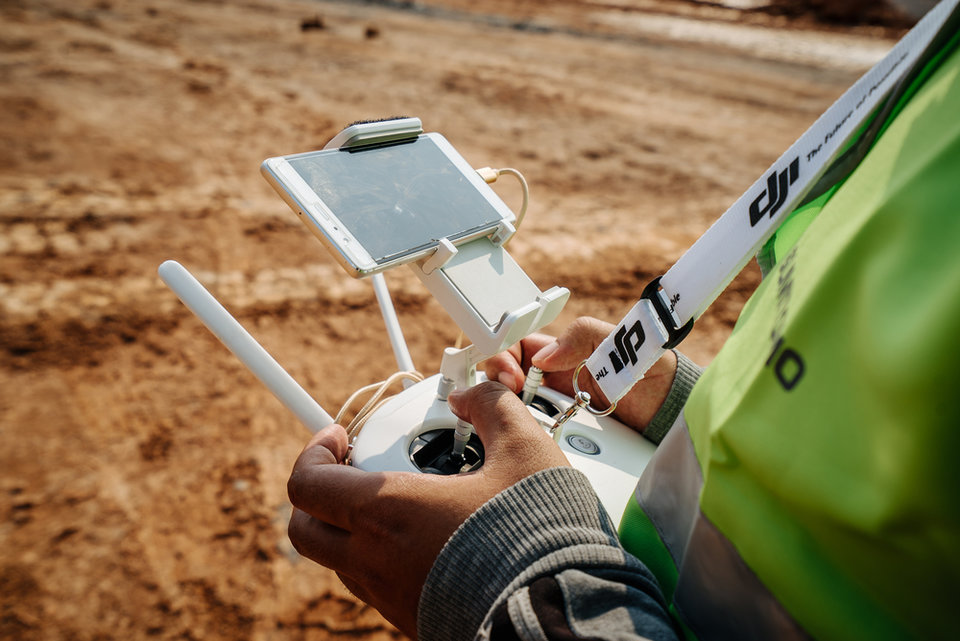
“We’ve been trialling drones fitted with military-grade cameras to provide real-time aerial footage and 3D maps of our sites,” says Knox. “This is far cheaper than using planes for survey work, and the savings at our sites in Queensland alone are estimated to be A$5m a year.”
These drone-based surveillance systems are being developed alongside supercomputers that will allow BHP to analyse the site and make decisions at far greater speeds than previously.
“With drones, we now gather more information about our sites than ever before,” Knox says. “We can more quickly and accurately measure our stockpiles, review compliance to design against mine plans and understand where we need to make changes to improve safety or boost productivity.”

The savings at our sites in Queensland alone are estimated to be A$5m a year
Military-grade UAVs and camera technology put drones far ahead of survey planes. Credit: WOVE LOVE/Shutterstock.

A drone pilot at a mine site can expect to make as much as A$200,000 a year
The drones are coming
Outside of site maintenance and development, BHP also expects drones to play a big role in its community work. This includes a current project where drones are being used to map areas of cultural heritage close to the mine sites.
“For me, the bigger picture is what this technology allows us to do that could never have been done before, and for us that means being able to share and preserve cultural heritage that might otherwise have been lost,” BHP heritage manager Daniel Bruckner said. “We’re now able to share all our footage with local Aboriginal groups and they’re excited about that possibility.”
There are lots of positive reasons for transferring to the use of drones within mining, but many are concerned about the effect they will have on employment. The mining industry has been employing fewer and fewer people for decades; in the US, mining jobs declined by 60% between 1980 and 2015. Automation has played a large role in this drop, as machines are increasingly capable of taking on tasks that were previously labour-intensive.
This trend seems likely to continue, as IoT and automation make more jobs obsolete. Automated trucks are already becoming commonplace at mine sites, improving efficiency while reducing the number of drivers required by mining companies.
While drones may reduce the need for traditional surveyors, should BHP’s trial prove successful, they will create a range of new, well-paid roles. A drone pilot at a mine site can expect to make as much as A$200,000 a year, equivalent to the salary of an airline pilot. It is one of a number of specialised roles being created by technology that require greater training opportunities to allow the mining industry to continue to develop apace.
“Technology will change the nature of work,” says Knox. “For example, with drones capable of delivering samples from site, surveyors will spend less time gathering data in the field and more time interpreting it. And soon, more drones could be managed by ‘pilots’ operating from a range of different vantage points.”
Drones look set to play an increasingly important role in mining operations around the world, increasing safety and productivity. Using them in mineral surveillance could save time and money, but a new generation of drone-capable surveyors must rise before it becomes commonplace.
Share this article!
Change is good and certainly the right noises are being made

Share this article!


