Company Insight
Sponsored by Emesent
Mapping the way to safer operations: how SLAM technology solves the data challenge
Queensland-based deep-tech company Emesent has spent years redefining how mining operations understand the ground beneath and around them.
Main image: Point cloud of fall and hazard detection.
Across the global mining industry, the same pattern is emerging regardless of jurisdiction: operational data is becoming as critical to a mine's performance as the ore body itself. Artificial intelligence and automation are moving from pilot projects to core infrastructure, and with that shift comes a harder question for every mining leader — not whether to adopt these tools, but how quickly critical data can be captured, connected, and acted on before the value is lost to delay.
Safety sits at the center of this shift. High-hazard activities like transportation, maintenance, and underground access continue to account for a disproportionate share of serious incidents, even as broader safety performance improves. At the same time, the industry is converging on autonomous systems and real-time monitoring as standard practice rather than experimental technology, driven as much by persistent workforce shortages as by safety and cost pressures. These aren't short-term trends tied to a single year; they describe the direction mining operations are moving in for the remainder of this decade.
The common thread is the quality and speed of the data that enables better decision making; how fast it can be captured, how safely, and how usable it is once it's in a mine planner's hands. This is exactly the problem SLAM-based mapping was built to solve.
Proven SLAM for GPS‑denied environments
Underground mines, sublevel caves, and tunnels share one defining trait: no GPS. Emesent's Simultaneous Localization and Mapping (SLAM) algorithm, developed with roots in CSIRO research, was purpose-built for exactly this problem, generating accurate, georeferenced 3D point clouds in confined, unstable, and complex conditions without relying on external positioning signals.

SLAM-based scan of the Carrapateena mega cave captured via autonomous drone.
At BHP's Carrapateena copper mine, a mega cave formed by sublevel caving grew to 187 meters wide and 255 meters deep — too large and too hazardous for terrestrial LiDAR, manned helicopters, or line-of-sight drone flight to assess. A Hovermap-equipped drone launched from outside the 200-meter exclusion zone, descended autonomously once it lost communication and GPS, and returned with a complete scan in 15 minutes. As Richard Cheung, Digital Robotics & Automation Architect at BHP, put it: "It is testament to the advanced autonomous capabilities of Hovermap that we were able to capture critical data for decision making that otherwise would simply not have been possible."
Autonomy that keeps people out of harm's way
Reducing human exposure to hazardous ground is a lever mining operators can pull today, not a future capability. When a limestone quarry client faced a 22-acre underground collapse, sending personnel in to assess it wasn't an option. Emesent partner UAS flew Hovermap over five kilometers of GPS-denied, flood-affected workings, including one "full send" mission beyond communications range, and delivered a full 3D scan of the collapse zone, without a single person entering the hazard area.
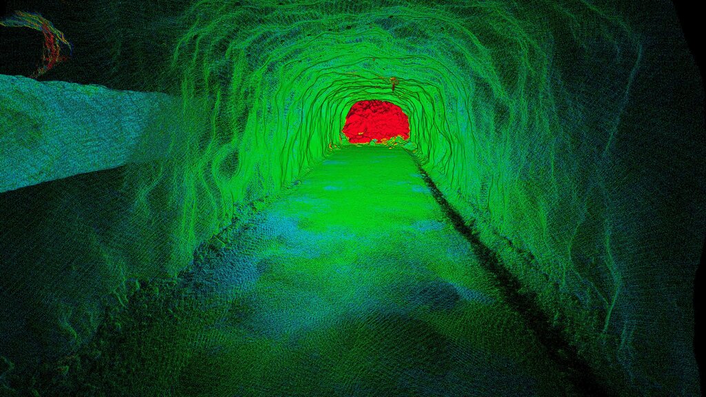
Rapid SLAM-based scan of environmental change detection.
As Matt Mackinnon, Founder and President of UAS, said: "The ability of Hovermap to enter areas that are completely inaccessible, capture data and return to safety autonomously opens up new opportunities for mine incident analysis and response."
Fast, accurate, and immediately actionable
Speed matters because delayed data is a production cost, not just an inconvenience. Emesent scanners capture void and drift data up to 75% faster than traditional survey methods, shortening the gap between a scan and a decision. Underground contractor Byrnecut saw this directly: stope hazard assessments that once took up to two days now take around 10 minutes with Hovermap LHD, mounted directly on load-haul-dump equipment, with a positive return within two to three hours of downtime prevention. Tim Campbell, Area Manager at Mining Plus, summed up the appeal of that simplicity: "No drone. No CMS. Plug in, start, stop and you have survey-grade scans. Anyone can do it."
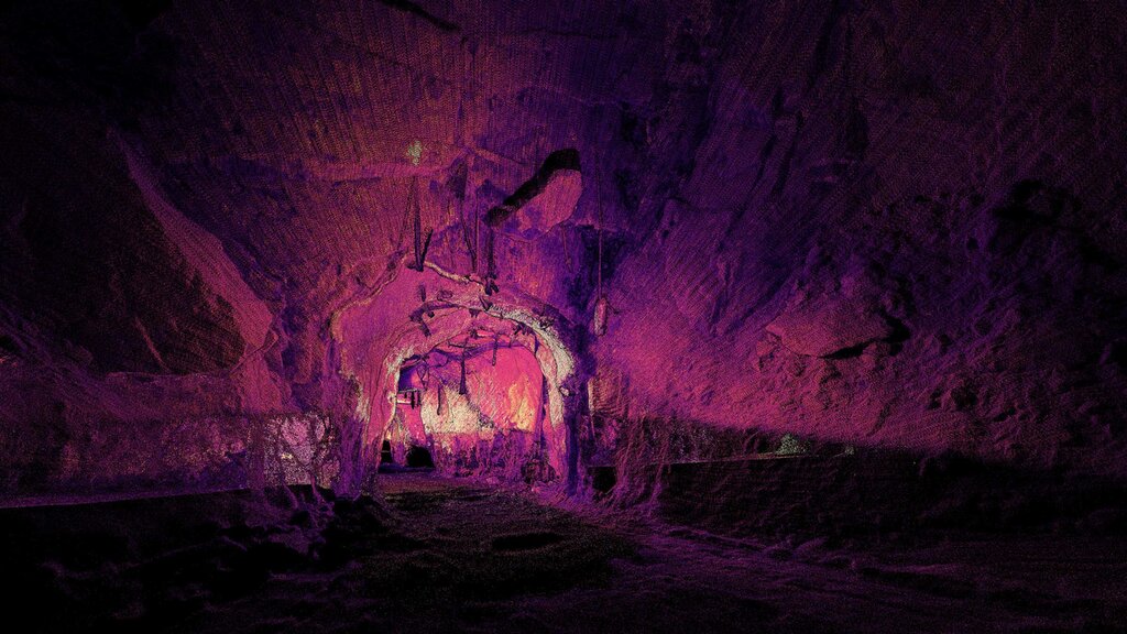
Hazards can be identified in unlit, dusty, and remote environments – deployed via drone, robot, vehicle, or backpack.
That versatility — the same underlying technology deployed handheld, drone-mounted, or fixed to a vehicle — is what lets a mine site apply one system across routine mapping and emergency responses alike, without retraining crews or reworking workflows for each use case.
The clearer way forward
None of this happens in isolation from the broader shift underway across the industry: digital transformation moving from advantage to baseline expectation, automation scaling beyond haul trucks into monitoring and inspection, and safety data increasingly treated as an asset to be shared and acted on rather than filed away. These are not fleeting shifts. They are the operating conditions mining companies will be working within well into 2027 and beyond. As the Carrapateena, Byrnecut, and UAS cases show, SLAM-based mapping isn't a novelty sitting alongside that shift. It's infrastructure for the mines that intend to keep pace.
Come see Emesent in action at IMARC 2026 booth #G34 and learn more about SLAM.
Contact information
Emesent - Head Office
Level 1, North Tower
339 Coronation Drive
Milton QLD 4064
Australia
Tel.: +61 7 3548 9494
Emesent - Europe Office
483 Green Lanes
London N13 4BS
United Kingdom
Tel.: +44 7472 195 813
Emesent - North American Office
9200 E. Mineral Ave. #100
Centennial, CO 80112
Web: www.emesent.com