Interview
Q&A: Automation takes flight in WA mineral exploration
AMLM CEO Ryan Cunningham explains how drone‑mounted magnetometry and AI are helping prioritise drill targets at the Higginsville Gold Project. Alejandro Gonzalez reports.

Main video credit: Soonios Pro / Shutterstock.com
Mining automation is increasingly moving into the earliest stage of the mining lifecycle: exploration.
According to GlobalData's Autonomous Mining: Unlocking Innovation and Competitive Advantage report, advances in AI, high-resolution geophysical surveys and three-dimensional geological modelling are helping miners make faster, safer and more informed decisions, extending automation across the mining value chain.
One technology driving that shift is drone-mounted geophysics. Equipped with high-resolution magnetometers, drones can survey prospective ground quickly and cost-effectively, while AI-assisted interpretation and 3D modelling help geologists identify drill targets before committing significant exploration capital.

Ryan Cunningham, CEO of American Mineral Resources. Credit: AMLM
American Mineral Resources, a brand under AMLM, is applying this approach at its recently acquired Higginsville Gold Project in Western Australia (WA). Located within the Southern Norseman-Wiluna Greenstone Belt, just 9km from the historic Higginsville Mine, the four-tenement project sits in a proven gold district with extensive historical drilling, rock-chip sampling and existing infrastructure.
Higginsville's geology makes it well suited to magnetic surveying. Gold mineralisation in the region is closely associated with major shear zones and fault structures, which magnetometry can map beneath shallow cover, allowing explorers to refine targets before drilling.
CEO Ryan Cunningham explains how drone-mounted magnetometry, AI-assisted data interpretation and geological expertise are being combined to guide exploration at Higginsville, and why digital technologies are changing not only how mines operate, but how they're discovered.
Alejandro Gonzalez: How much has exploration changed during your career?
Ryan Cunningham: The transformation has been extraordinary. When I started out, exploration was almost entirely boots on ground, people were relying on hand samples, paper maps, and expensive fixed-wing geophysical surveys that took months to commission and even longer to interpret. Today, a small team can deploy a drone magnetometry system over a target area in days, process the data in the cloud overnight, and have AI-assisted anomaly maps ready before the field crew has left site.
What hasn't changed is the geology. The rocks don't care about the technology, you still need experienced geologists who understand structural controls, mineralisation styles and the regional context. What's changed is how fast and how cheaply we can screen ground and prioritise targets before we put a drill bit in. That's a genuine step-change in capital efficiency, and for a company like American Mineral Resources, where we're managing a portfolio across multiple continents, that matters enormously.
What hasn't changed is the geology. The rocks don't care about the technology, you still need experienced geologists who understand structural controls, mineralisation styles and the regional context. What's changed is how fast and how cheaply we can screen ground and prioritise targets before we put a drill bit in. That's a genuine step-change in capital efficiency, and for a company like American Mineral Resources, where we're managing a portfolio across multiple continents, that matters enormously.
Alejandro Gonzalez: How central is magnetic surveying to a modern gold exploration programme?
Ryan Cunningham: Magnetics is often the first geophysical tool you reach for in an Archaean greenstone setting. Gold mineralisation in these terranes is almost always structurally controlled, you're looking for shear zones, faults, lithological contacts and magnetic data is exceptionally good at mapping those features even under cover. It's cost-effective, non-invasive, and the datasets integrate cleanly with geology and geochemistry. For greenstone gold, it's close to indispensable.

Credit: corlaffra / Shutterstock.com
Alejandro Gonzalez: What geological features are you hoping magnetics will reveal at Higginsville?
Ryan Cunningham: Higginsville sits on the western limb of the Greater Eundynie Anticline, within 2km of the Zuleika Shear Zone – one of the major gold-controlling structures in the Eastern Goldfields of WA. The tenements host faulted, thrust-repeated mafic and ultramafic sequences that have been through at least two deformation events: compression and later fracturing.
What we're specifically targeting are the north-west-trending fault systems that run parallel to the Zuleika Shear, and the cross-cutting north-east faults. The nearby Challenge-Swordsman operation produced 250,000 ounces from this structural setting in the 1990s, and the Higginsville Mine itself has over 1.1 million ounces of historical production. Magnetics will help us map those fault corridors precisely and identify where they intersect – those intersections are classically where gold deposits concentrate in this belt.
Alejandro Gonzalez: Do you work with specialist geophysical contractors, or do you bring capabilities in-house?
Ryan Cunningham: At this stage we work with specialist contractors. The Australian Goldfields market has excellent geophysical service providers with deep experience in Archaean greenstone surveys, and it makes more sense to leverage that expertise than to replicate it in-house.
What we bring in-house is the geological interpretation - knowing what questions to ask of the data and how to integrate it with the structural and geochemical picture.
Alejandro Gonzalez: Do drone mounted magnetometry results justify the cost?
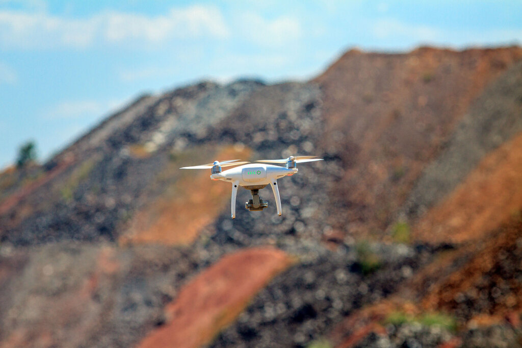
Ryan Cunningham: Absolutely, in most cases. The cost per line-kilometre for drone mag has come down dramatically, and the ability to fly safely at low altitude gives you better resolution for the same budget. The real question is whether the survey is designed well enough to answer the geological question you're asking. A cheap survey that doesn't resolve your target is money wasted; a well-designed drone mag survey that identifies a drill target is one of the best returns on exploration capital you can get. Beats helicopters on cost hands down.
Credit: Maksim Maksimovich / Shutterstock.com
Alejandro Gonzalez: Once the survey has been completed, what happens next?
Ryan Cunningham: The raw data goes through processing – levelling, filtering, and gridding – before you start interpretation. We look at total magnetic intensity and reduced-to-pole maps, then move into analytical signal and tilt derivative products that help resolve edges and contacts. That interpretation gets overlaid onto the geology and any existing geochemical data. Where anomalies align with favourable structural positions and geochemical signatures, you have a drill target.
Alejandro Gonzalez: How much interpretation is automated and how much still depends upon experienced geologists?
Ryan Cunningham: The processing is largely automated – the algorithms are well-established. But interpretation is still very much a human exercise. Pattern recognition in magnetic data requires understanding the regional geology, structural history and the mineralisation model for that specific terrane. AI tools are starting to assist with anomaly detection, but the experienced geologist sitting with the data asking “why does this anomaly exist, and does it make geological sense?” is still irreplaceable.
Alejandro Gonzalez: Where does AI provide the greatest value in exploration today?
Ryan Cunningham: Right now, the clearest value is in data integration and target generation – taking large, heterogeneous datasets and identifying spatial correlations that human analysts might miss or take weeks to work through. AI is also showing real promise in drill core logging, where computer vision can identify lithological and structural features with consistency that's hard to maintain over thousands of meters of core.
I'm more cautious about AI as a primary decision-making tool for drill targeting. The geological reasoning still needs to be there – AI can surface candidates, but experienced geologists need to ground-truth them against the actual geology before capital gets committed.
Alejandro Gonzalez: Is 3D inversion modelling becoming standard practice?
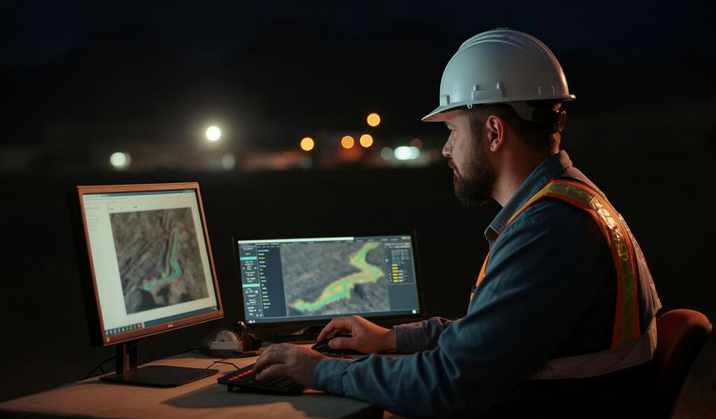
Ryan Cunningham: Increasingly, yes. 3D inversion converts your magnetic data into a volumetric model of subsurface rock properties – a much more intuitive picture than 2D maps alone. Reliability depends heavily on the quality of input data and the geological constraints you feed in. When constrained by real drill data and good geological understanding, it can be a powerful predictor. Like any model, it's a hypothesis to be tested, not a fact to be trusted blindly.
Credit: Shutterstock.AI
Alejandro Gonzalez: How extensive was the drone survey at Higginsville?
Ryan Cunningham: To be transparent, American Mineral Resources acquired the Higginsville tenements in April 2026, and our own fieldwork programme is planned to commence in the second half of 2026. The historical geophysical and geochemical work was conducted by previous tenement holders. Our immediate focus has been integrating that historical dataset, including the 152-hole air-core programme and existing geophysical coverage to define priority drill targets before we go back into the field.
Alejandro Gonzalez: And what did the magnetic survey reveal?
Ryan Cunningham: The historical data confirms the tenements are positioned on a highly prospective structural corridor. The north-west-trending fault system parallel to the Zuleika Shear and the cross-cutting north-east faults are clearly expressed in the geophysical data. Rock chip sampling from the Rainbow Waters prospect returned nine samples above 1.2 grams per tonne (g/t) of gold with a peak of 8.26 g/t, and surface prospecting has recovered nuggets up to 27 ounces, clear evidence the structural and mineralisation system is active across the tenement package.
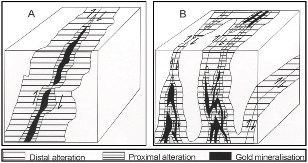
Schematic comparison of gold mineralisation associated with (A) a simple quartz vein or shear zone and (B) a more complex system containing multiple subsidiary veins and shear zones. Credit: AMLM
Alejandro Gonzalez: How directly did the survey influence your drilling programme?
Ryan Cunningham: The historical dataset has directly informed our target prioritisation. We have 164 historical drill holes, multiple prospect areas with rock chip sampling, and geophysical data to integrate. Our drilling programme, planned for the second half of 2026, will test the structural intersections identified in that combined dataset, particularly the north-west/north-east fault intersection zones that are the classic loci for gold deposition in this belt.
Alejandro Gonzalez: What milestones should investors expect over the next 12 to 18 months?
Ryan Cunningham: Completion of target definition and drill programme design; commencement of drilling at priority targets; and initial assay results. Higginsville is a cornerstone of American Mineral Resources' global footprint – we now operate across 12 projects in seven jurisdictions on four continents, and the Eastern Goldfields is one of the world's premier gold addresses.
Title
With diesel vehicles accounting for 30% to 50% of greenhouse emissions at a mine site, replacing them with a battery-electric fleet is a sure way to drastically reduce overall CO2 emissions, but how else can mines benefit from this technology?
Leading underground manufacturers Normet believe the answer lies with SmartDrive. This architecture for battery electric vehicles (BEV) was developed in collaboration with customers, building on feedback, predicting future trends, and assessing the limitations of diesel engines, and comes with a wealth of benefits for operators.
Title
TowHaul Lowboys are front loading which is crucial for three main reasons:
Speed – the Gooseneck can connect and disconnect in as little as 90 seconds
Safety – the full width of the lowboy rests on the ground providing a wide, stable loading platform
Versatility – the multi-purpose gooseneck can be used to tow disabled haul trucks or other specialty TowHaul trailers (Dragline Bucket Transporter or Water Tank Carrier)
The “Low-Profile” designation refers to the load ramps of the lowboy which are designed in such a way as to reduce the “breakover” as the equipment transitions from the ramps to the lowboy deck.
The “Modular” aspect refers to how the lowboys are designed, manufactured and shipped. Each module is easier to handle and ship which substantially lowers shipping costs for our clients, especially those overseas. Once onsite, the modules are pinned together which minimizes installation time (3-5 days).

TowHaul Lowboys utilize a single, haul-truck type axle. TowHaul offers a dry drum brake configuration or a wet brake configuration with TowHaul’s patented Brake Cooling System.
Frank Smith, Founder and CEO of TowHaul
TowHaul Lowboys utilize a single, haul-truck type axle. TowHaul offers a dry drum brake configuration or a wet brake configuration with TowHaul’s patented Brake Cooling System. Using a single axle eliminates tire “skidding” often found with multi-axle trailers when turning on a sharp corner. This “skidding” can cause tire and axle damage leading to downtime. Recognizing the variety of conditions in which mines operate, TowHaul has designed specific lowboy configurations tailored to operate more effectively in specific areas. For example, there are several TowHaul Lowboys currently operating in the unique conditions found in the oil sands of northern Alberta designed with a specific Oil Sands Configuration.
To cope with the extreme ambient temperatures found in Western Australia, TowHaul upgraded the patented Brake Cooling System for our 450-ton capacity lowboys to improve the cooling of the oil in those systems.
Mining industry needs clarity
Macfarlane has been critical of taxation policy in the past, branding it a ‘threat’ to mining in and suggesting it puts the local sector at a disadvantage compared with other regional sectors across the country.
“Coal royalties in Queensland are the highest in the country and more than double the rate of New South Wales. Latest figures show the resources industry is delivering A$5.2bn to the State Budget in royalty taxes, including A$4.36bn from coal. These are record returns and they show the importance of the resources sector to the state budget. We have asked for certainty about royalty tax rates to ensure stability for long-term investments and the jobs they create.”
In early June 2019, mining companies avoided increases to royalties by agreeing to provide A$70m to a A$100m infrastructure fund.
Frank Smith, Founder and CEO of TowHaul
In early June 2019, ahead of Queensland’s State Treasurer Jackie Trad’s budget, mining companies avoided increases to royalties by agreeing to provide A$70m to a A$100m infrastructure fund. The move means coal royalties will be frozen for three years.
“We have welcomed the commitment from the Queensland Opposition to freeze royalty tax rates for 10 years, and we’d like to see a similar commitment from the Government,” says Macfarlane. “We want to keep employing more Queenslanders and supporting more regional communities through local investment. To do that, it’s essential that we have clear and transparent rules and regulations,” he adds.
Will politics continue to support mining?
Politics and mining often overlap - unsurprisingly given the value of the sector to the wider Australian economy. That was on display during the recent federal election, which saw the industry used as a political tool– particularly Adini’s controversial Carmichael coal mine in the Galilee Basin.
However, the re-election of Scott Morrison as prime minister was welcomed by many within mining, and the almost complete annihilation of Labor’s vote in the state sent a clear message to politicians about how Queenslanders view the sector. Before the election Labor had failed to take a meaningful position on the project but appeared likely to oppose it. The party suffered heavy losses, hampering its ability to have a significant say at a state level. Olive Downs is a case in point, just days after the vote Queensland’s government gave final approval to the project, which had been stuck for years.
Keen to stress the need for a broad political approach to mining, Macfarlane says: “The QRC works with all sides of politics constructively, including the re-elected Coalition Government in Canberra. The Government has been a strong supporter of the resources sector through the Prime Minister and Resources Minister Matt Canavan.
Phillip Day. Credit: Scotgold Resources
“The resources industry has also welcomed the appointment of Joel Fitzgibbon to the shadow resources portfolio. We want to see bipartisan support for the resources sector and the regional jobs it creates. We want to see the Government and the Parliament focus on attracting new investment to create new jobs well into the future.”
Queensland’s mining industry is a vital part of the economy and has a promising future. However, nothing can be taken for granted and business, politicians, and local communities need to be ahead of the issues the future may bring MacfarlaneWe must embrace technology to stay globally competitive, compete for every contract and earn the support of our governments and the people who elect them. believes.
“Our sector makes up almost 20% of the Queensland economy but we must not get complacent. We must embrace technology to stay globally competitive, compete for every contract and earn the support of our governments and the people who elect them,” he finishes.
