Company Insight
Sponsored by Emesent
Safer scans, faster answers: Emesent's autonomous approach to mine data
Queensland-based deep-tech company Emesent has spent years redefining how mining operations understand the ground beneath and around them.
Main image credit:
Queensland-based deep-tech company Emesent has spent years redefining how mining operations understand the ground beneath and around them. Built on autonomous drone and LiDAR mapping technology, Emesent's flagship Hovermap platform allows mines to capture survey-grade 3D data in places no person, and no traditional survey method, can safely reach — GPS-denied stopes, collapsed workings, and challenging environments hundreds of metres underground.
From SLAM research to the gold-standard in underground mapping
Emesent's origins trace back to CSIRO's Data61 SLAM (Simultaneous Localisation and Mapping) research program, commercialised to solve a problem mining has wrestled with for decades: how do you accurately measure the parts of a mine too dangerous, remote, or unstable for people to enter? The answer became Hovermap: a LiDAR-based autonomous mapping payload that can be mounted on drones and ground robots, and that navigates entirely without GPS using real-time spatial analysis.
Today, Hovermap is trusted at over 300 underground mines globally. Manufacturing is based in Wacol, Queensland, and the technology is exported to more than 40 countries. Emesent's broader portfolio now spans the GX1 all-in-one scanner, the Cortex autonomy engine, Aura processing software, and the Commander mission-planning app — together forming an end-to-end system for capturing, processing and acting on underground spatial data. Hand-held, vehicle, backpack, cage and pole mounted options are also available.
Solving mining's hardest data problem
Underground mining generates constant demand for accurate, timely spatial data — for stope reconciliation, cavity monitoring, ore pass inspection, ground control and geotechnical assessment. Traditional Cavity Monitoring Systems require an operator to work near as possible to the stope edge, exposed to fall-of-ground risk, poor air quality and unstable geotechnical conditions, often returning incomplete datasets that force repeat visits.
Hovermap removes the operator from the hazard zone entirely. A single surveyor defines a virtual scan boundary in Commander and, within minutes, Hovermap autonomously explores voids as narrow as 2.4 metres, capturing complete point clouds without a pilot, without line of sight, and without a continuous radio link. Onboard processing delivers visualisation in the field, significantly cutting time to insights where it matters most. As one Senior Mine Surveyor at Mount Isa Mines put it after using the exploration feature on a large broken ore pass: it "captured everything."
Caption. Credit:
Real-world proof: real-life value
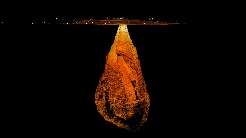
The Carrapateena mega-cave. When a 5-metre diameter hole opened at the surface of the Carrapateena copper mine in South Australia in 2023, mandatory exclusion zones made conventional monitoring impossible. Hovermap gave the operation a way to capture regular, accurate scans of the growing cavity autonomously, informing both personnel safety decisions and the ongoing stability assessment of one of the world's largest copper reserves — without putting anyone near the void.
A 22-acre collapse, mapped in 48 hours. When a catastrophic fall of ground affected roughly a quarter of an active limestone mine in Iowa, USA, Unmanned Aerial Services Inc turned to Hovermap STX to assess the damage. Flying up to 1.3 kilometres one-way through GPS-denied, partially flooded drifts — with as little as 20 centimetres of propeller clearance and stretches of communication blackout — Hovermap autonomously mapped more than five kilometres of workings in under 48 hours. The resulting 3D data revealed the full extent of the collapse, identified water impoundment contributing to instability, and — critically — was overlaid with a historical baseline scan to reveal progressive ground degradation that had gone unnoticed for years. The mine has since adopted Hovermap for routine, proactive scanning.
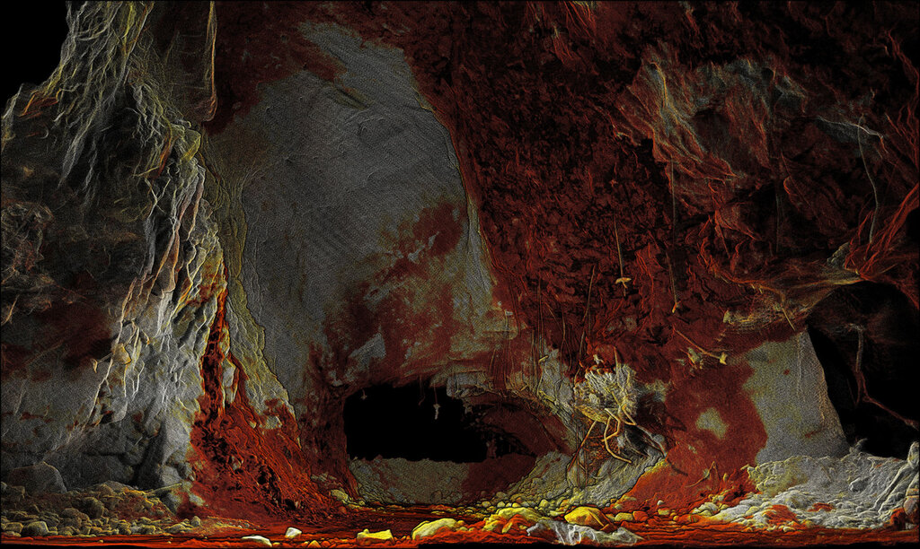
Autonomous stope mapping. Building on this reliability, Emesent's latest Cortex-powered release lets a single surveyor launch a fully autonomous scanning mission from a safe distance and walk away with complete, validated data, with Hovermap mapping areas with the speed and precision that manual CMS surveying cannot match.
Caption. Credit:
Why it matters – especially in GPS-denied environments
Across these examples, the pattern is consistent: autonomy removes people from harm's way, Emesent SLAM delivers the precision mines need for engineering and compliance decisions, and rapid, repeatable LiDAR data capture turns what used to be reactive emergency response into proactive risk management. For an industry where the cost of a missed hazard is measured in lives saved as much as millions of dollars, that shift — from occasional, high-risk manual surveys to routine, autonomous, safe data capture — is what Emesent has built its mapping solutions around.
Beyond the single scan
Emesent's mining relevance extends well past any single scan. The same Hovermap hardware supports open pit mapping on demand, stockpile measurement, convergence and change monitoring, and underground production surveying. This means a site can standardise on one platform across its entire operational lifecycle rather than stitching together separate tools for separate problems. Platform versatility matters underground in particular: Hovermap performs identically in darkness, dust or smoke, conditions where camera-based systems fail outright. Data can also be exported to other platforms for further analysis as needed.
Platform versatility, paired with a track record of deployments across the world's toughest mining environments, is why operators increasingly treat Hovermap as a core piece of operational infrastructure rather than an emergency-only tool — equally comfortable running a scheduled stope scan as responding to a fall of ground overnight. It is this dual use, capable in both crisis and routine, that defines Emesent's position in the mining sector today.
Come see Emesent in action at IMARC 2026 booth #G34 and learn more about autonomous mapping.
Contact information
Emesent - Head Office
Level 1, North Tower
339 Coronation Drive
Milton QLD 4064
Australia
Tel.: +61 7 3548 9494
Emesent - Europe Office
483 Green Lanes
London N13 4BS
United Kingdom
Tel.: +44 7472 195 813
Emesent - North American Office
9200 E. Mineral Ave. #100
Centennial, CO 80112
Web: www.emesent.com