Technology
Autonomous exploration: the potential for drones in the mining industry
Drone technology has the potential to be one of the most disruptive in the mining industry, especially as prices fall and the drones become more available. JP Casey considers the potential of drones to impact the mining industry in general, and exploration work in particular.
O
f all the buzzwords in the mining industry, 'drones' and 'automation' are among the most prevalent, and with good reason. The latter has seen extensive interest from actors across the mining industry, with Australia in particular emerging as an epicentre of autonomous technology and research, while the potential for mapping and information-gathering of the former is an attractive proposition for miners who are forced to search farther afield for mineral deposits to meet the world’s insatiable appetite for commodities.
Indeed, the mining industry may be reaching a tipping point where these technologies are moving from shiny new ideas to established and well-embedded components of the sector, especially within the field of exploration. With many of the world’s untapped and unidentified mineral deposits difficult to reach on foot, or simply isolated from human settlements and development, the prospect of an independent drone conducting mineral surveys far from human oversight is appealing.
Yet technological and human challenges remain, with the drones themselves an imperfect solution, and the prospect of replacing human workers with intelligent machines one that could set a dangerous precedent for the future of mining. Can these obstacles be overcome, and the exploration potential of drones ever be realised?
Drones for the present, drones for the future
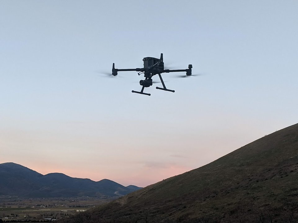
The benefits of drones in the exploration industry are obvious, as they offer a means to take photographs from great heights, and in relatively remote locations, that can capture a great swath of the environment. Yet their benefits go beyond mere photography, with the process of orthoimagery offering a much more sophisticated snapshot of an environment.
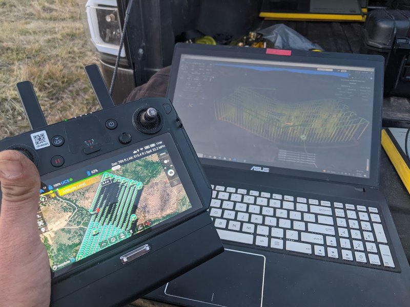
“The drone collects photographs that are embedded with telemetry, including the spatial position of the image sensor at the time each photograph is collected,” explains Mike Murphy, director of exploration and landman at mining consultants Burgex, which offers orthoimaging services to clients.
This standardisation of space allows miners to view and assess potential mining spots in much greater detail than simple photographs, allowing them to plan the size and scope of mining projects before they break ground. In addition, as Murphy explains, this approach minimises the distorting effect of terrain and environmental features that can often interfere with planning work.
“A good portion of the areas that we perform our work in contain a significant amount of terrain relief; [for] a project we just did a few weeks ago in Oregon, we were looking at about 1,000 acres of area where there's historic mining and the relief just within that area of interest was over 2,500 feet,” Murphy continues. “There's significant slopes, there's rock outcroppings, dense vegetation, trees and so forth.

During post-processing, ground survey points and topographic data are used to further geometrically correct [and] merge spatially adjacent images.
“During post-processing, ground survey points and topographic data are used to further geometrically correct, merge spatially adjacent images, or ortho-rectify such that measurements taken from the photo mosaic or group of photographs are consistent. A pixel will represent a given amount of space so you can make very accurate distance measurements across the image and there is no distortion created by terrain.”
These terrain images also serve a purpose in the long term. Their complexity means that they can be used as the basis for environmental rehabilitation work, which is completed decades after a mine is first built, enabling miners to rebuild the environment as it appeared before the mine was even built.
“It behoves our clients to have an image or a group of images of the ground surface before disturbance, because it's part of the permit that you're required to renovate the land once mining has completed 20, 30, 40 [or] however, many years later,” says Murphy, pointing out how state and national requirements for land rehabilitation in the US in particular mean that orthoimagery can be especially effective there.
"[The company will] be required by the governmental agency to come back and recover or renovate the land back to the status that was prior to disturbance, so they would have a historic map or a large ortho-mosaic showing.”
//Credit: Burgex
Challenges unique and universal
Despite these potential benefits, there are obstacles to the more widespread adoption of drones in the exploration sector, beginning with the environment itself.
"Weather isn't as much of a factor [underground] of course, but above ground, most drones cannot fly even in a light rain,” explains Murphy. “Then lighting conditions need to be appropriate to collect proper images.
"You don't want the sun angle to be such that you're getting a large amount of shadow [and] typically we don't collect those if there's any snow cover at all, because that'll affect the ground height, because one of the primary deliverable products from the aerial survey isn't just the photographs, it's also a 3D model of the land surface."
Difficult environmental conditions could prove a long-term sticking point for drones, not just in mining but in a range of industrial activities, as light, rain, and snow are not factors that can be controlled by human actors. However, many of the other challenges facing drone operators are ones not unique to drones and could be alleviated by technological advancement across the sector more broadly.
One of the constraints, of course, would be not having access to a wireless network in most of the areas where we operate; they're very remote.
"One of the constraints, of course, would be not having access to a wireless network in most of the areas where we operate; they're very remote. The technology must capable of being completely standalone and many drone packages require the same type of wireless conductivity and with the national network; if you have no cell phone connectivity, there's nothing with which to connect."
He continues: "And then of course capacity. [For] the datasets that we're collecting, [across] 700 acres, 800 acres, you're taking 7000 images, each of those images is in the neighbourhood of 12 megabytes. So adding all together [makes] hundreds of gigabytes of data, then you run into limitations with CPU capacity, processing capacity, and then even storage capacity.
"Are you going to store that in a local server or in the cloud? And then there's an expense involved with that and makes it difficult, bringing in all these data types in a large survey and being able to interact with it and manipulate it zoom and pan.”
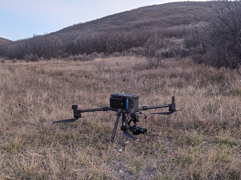
Yet as communications technology develops, as does the efficiency and availability of storage solutions, these issues may not prove to be a long-term threat to the viability of drones. Indeed, Murphy ads that smaller drones, especially those used to map underground passages, could lack the power to carry sensors and power packs, which can account for up to two thirds of the weight of some drones, but this could be alleviated by the effects of the miniaturisation of technology affecting a range of industries.
//Credit: Burgex
The future of work
Murphy also pointed out that, contrary to apocalyptic warnings about intelligent machines taking jobs from human workers, there will always be a role for humans in mapping and exploration.
“There's always going to be the need for the human being to be there, at least in a monitoring capacity,” says Murphy. “Because there'll be an anomaly with various things, whether it's a drill rig, whether it's a haul truck, there's going to be something that comes up, that's going to require a human being to be monitoring those things."
The future of work in mining exploration, therefore, is not one where jobs simply do not exist, but one where jobs change in their nature, from operating a camera and soil sampling devices directly, to overseeing the operation of a drone.
Murphy notes that, at least for Burgex, this shift towards reskilling and re-training workers has led to a hiring philosophy that values flexibility and capacity for learning, rather than proficiency in a particular static skill, a move that places the mining exploration sector squarely in line with a number of other industrial sectors experiencing a rapid growth of autonomous technology.
It's more about finding the right people from the get-go who have the capacity to be trained.
“We don't have large groups of individuals that now their job is obsolete and we have nothing for them to do. It's more about finding the right people from the get-go who have the capacity to be trained to be able to do the hard physical labour and have the mental capacity to be able to adapt to new technologies, troubleshoot them and utilise those in the field,” he explains.
"We'll have people who don't have high level training, but they're an excellent field tech. Those people certainly have the capacity to learn how to operate these things and programme them, and so that's where we've moved into.”
There is also what Murphy calls a “safety function” associated with the growth of drone technology, where human workers are no longer required to enter potentially dangerous or remote environments to complete exploration work, a move which would be of direct benefit to human employees, rather than a threat to their employment prospects.
While it remains to be seen if Burgex’s emphasis on flexibility and reskilling can be effectively applied to the mining industry more broadly, the company’s work could set a precedent for balancing increasing automation and human employment in the mining industry.
// Main image: 3D System Model and Completed Installation. Credit: Deimos
// Main image Credit: Burgex